

Commentary: California needs smart water policy, guided by data
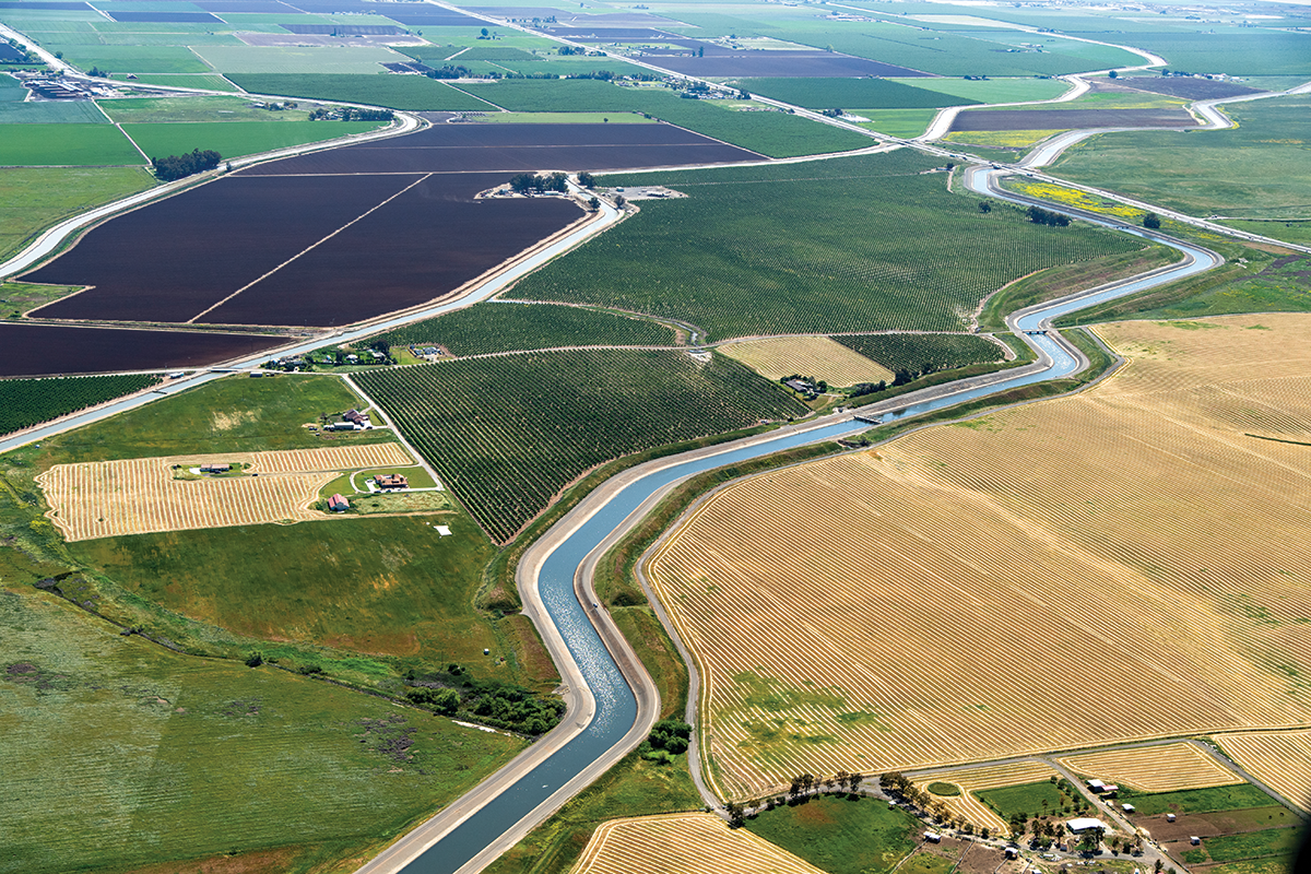
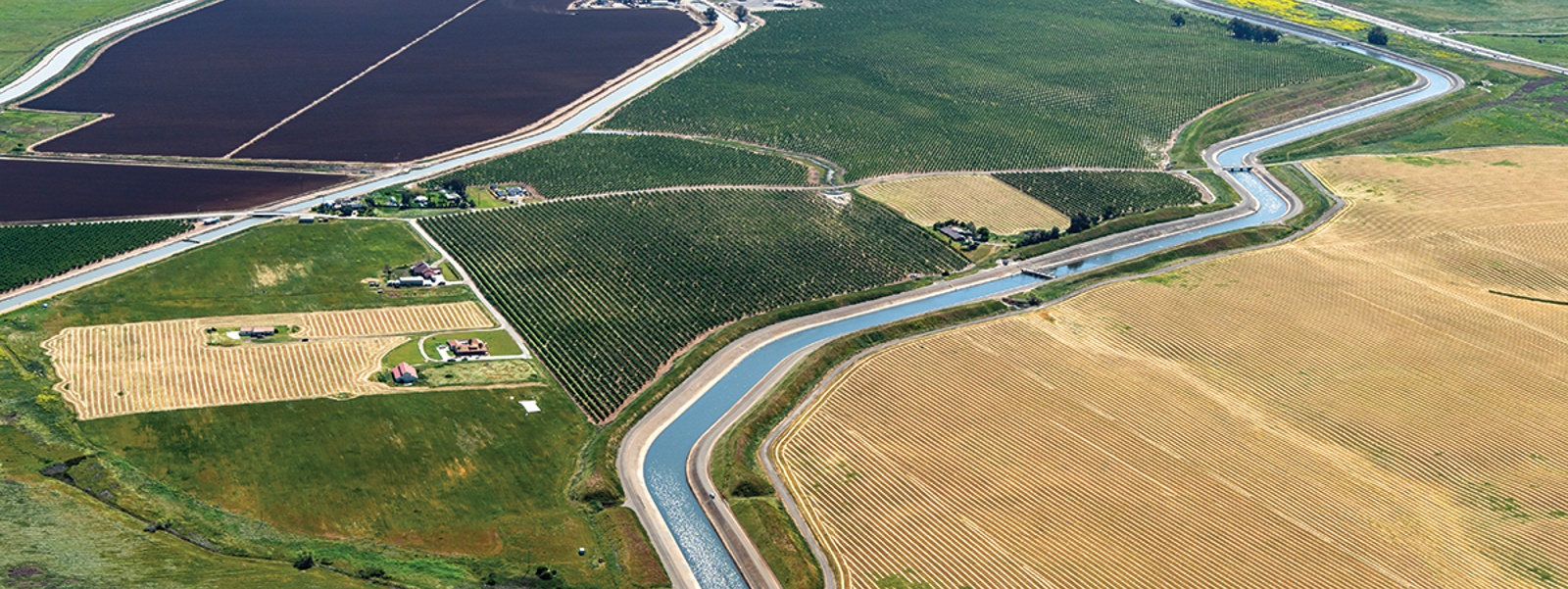
The California Aqueduct and the Delta-Mendota Canal flow past farmlands. Climate extremes continue to test the state’s water system.
Photo/California Department of Water Resources


By Justin Fredrickson
Advocates for California agriculture have had quite a bit to say about the state’s maddening failure to capture more water in wet years when it’s available. We have also expressed related concerns about fixing the burdensome water rights permitting process, which can begin to correct some of this problem.
Despite legislative and administrative attempts to authorize temporary 180-day and five-year permits to allow harvesting floodwater to recharge depleted groundwater supplies, few permits have been secured. The timing of approvals is also often out of sync with the timing of available water.
A March 10 executive order by Gov. Gavin Newsom during the atmospheric storms made it easier for agricultural landowners to divert excess water to recharge aquifers and reduce flooding dangers. It was a major step, yet the long-term process needs to be further streamlined for a durable solution.
Scaling up groundwater recharge throughout California is critical for a more resilient water system, including bringing depleted aquifers into balance, preventing land subsidence and boosting water supplies. It can also benefit streams, wetlands, and domestic and small community wells.
But improving California’s water picture also depends on something far more mundane: data. Currently, our state’s lack of adequate water use data may be gumming up the works by making water policy decisions more difficult and delaying progress on needed water improvements and infrastructure.
California lawmakers this year have introduced a variety of bills aimed at the water-rights system, including divisive proposals to expand the state’s already ample authority to regulate water resources. Solid information and data can lead to better proposals, to less legislative drama and better conceived policy solutions.
Who’s using how much water, when, where and for what—and how much water there is to begin with—is something on which, regrettably, we have only a rudimentary handle here in California—ironic for the home of Silicon Valley, which has turned data collection into a high-tech art form.
Addressing our water woes requires rehabilitating, building upon and adapting the complex network of reservoirs, canals, recharge basins and more that California’s future demands. We need robust water system upgrades to meet the needs of our growing population and support the farmers and ranchers who produce our food. We also must do better on our management of fish, rivers and habitat, as well as drought and flood management. Without good, usable, well-integrated and readily accessible water data, all of this is made much harder.
California, in fact, has veritable mountains of water-related data sitting in paper archives and various disconnected systems around the state that can be used to evaluate our vast and incredibly complex statewide water system. But this wealth of raw data is often fragmented and inaccessible. California needs an integrated, modern system for its water data. Our current system doesn’t match the demands of our 21st century water challenges, which are rapidly evolving in the face of climate change and weather extremes.
But there is growing awareness of this—and things may now be changing.
The Division of Water Rights of the California State Water Resources Control Board held a webinar on Gov. Newsom’s strategy document, “California’s Water Supply Strategy, Adapting to a Hotter, Drier Future.” The plan calls for accelerating water projects and modernizing how the state manages water through technology.
California is taking important steps toward creating a 21st century water rights database to be completed in 2025. Efforts to compile better and more timely water use data are underway in other areas as well, including in rebuilding and updating the state’s spotty, long-neglected river gauge system.
There is also ongoing work to improve and better integrate data from sources, such as airborne snow observatory technology, 3D electromagnetic aquifer surveys, well monitoring, forecast-informed reservoir operations and satellite-based estimates of evapotranspiration, soil moisture and vegetative conditions around the state.
People dealing with California’s complex water issues are gradually coming around to the view that compiling better water-use data is a friend and not a foe to be eyed with trepidation. Data may be an antidote to misinformation, unproductive bickering over water policy or to paralyzing uncertainty and endless red tape.
Empirical sources of well-coordinated water information can help to ensure existing water-rights priorities are working as designed in times of scarcity. It can help us get out of the business of serial crisis management, while guiding California in its needed quest to save more water for dry years during wet-year windows of water abundance.
Having better data can support water markets and help us to consider fully informed tradeoffs and balance limited water resources reasonably among all beneficial uses. And it can reduce the uncertainty that has long plagued and stymied progress on water issues in California.
(Justin Fredrickson is a water and environmental policy analyst for the California Farm Bureau. He may be contacted at jef@cfbf.com.)
